14 April 2024 Colorado Basin Drought Update
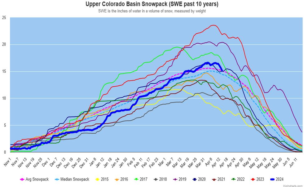
The water year begins on October 1 and ends on September 30. That can cause some confusion when comparing data because some declare the water year as the year it begins, others as the year it ends.With this winter"s sorms in the southwest, the snowpack is 100% of the 30-year average (23 or which are drought years) - we should have a good snowmelt this year. Todays statistics: Precipitation is 98%, rivers feeding Lake Powell are 62%, and snowpack is 100%, of average. And the eastern Utah mountains snowpack feeding Lake Powell are well above average. Climate change is creating all kinds of havoc world-wide; last year's record-breaking precipitation in the Colorado Basin may be a one-year anomoly. It is going to take several years of above average snowpack if this 24-year drought is going to end, the worst in 1,200 years [PBS News and other news sources]. The Ancestral Puebloans left the four corners area around 1,200 years ago, presumably because of a 50-year drought [Edwin Barnhart, PhD, Maya Exploration Center]. Select a graph tile above for a large version of the graph. We are 3+ months into the water year.
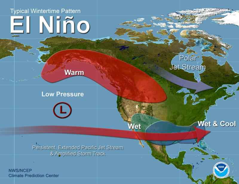
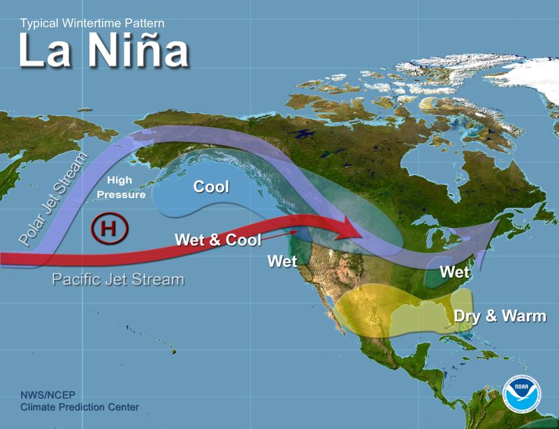
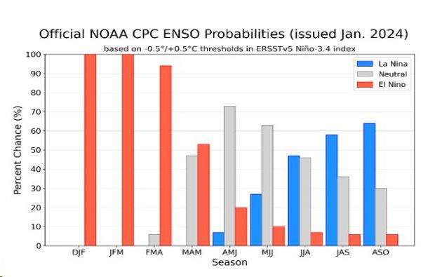
From the Weather Channel: the 2023-24 el Niño is weakening and expected to
become La Niña this summer
[image links added by SCC] - (NOAA chart).
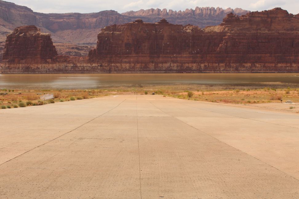
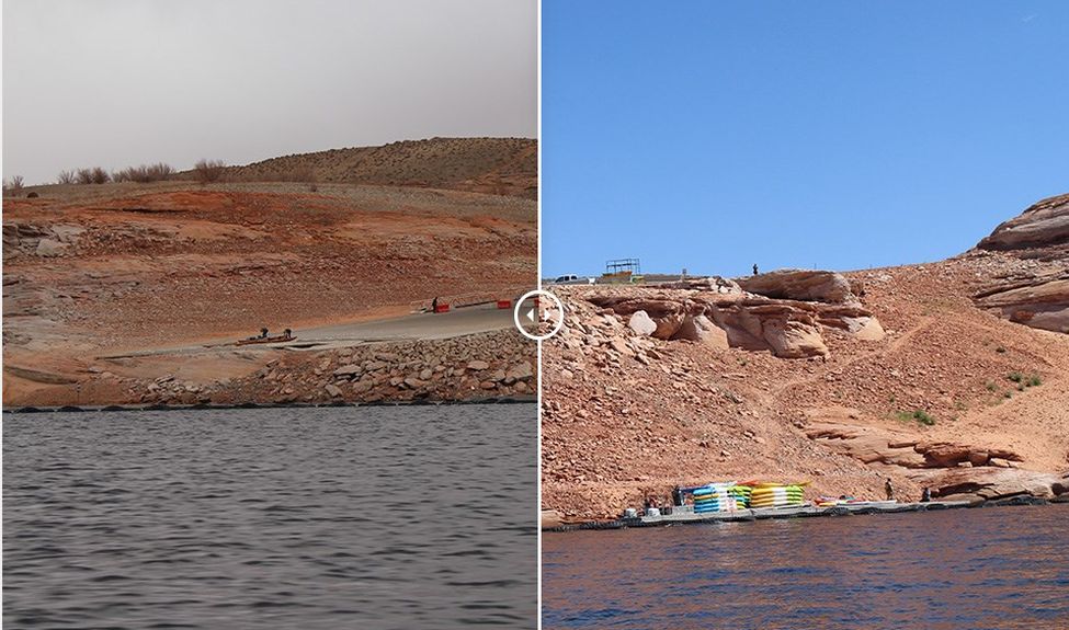
Lake Powell is 141.7 feet (43.2 m) below full pool at 31.5% of capacity, 38.4 feet (11.7 m) above this date last year, above the elevations of 2022 and 2023. Many Lake Powell marinas are open. Changing Lake Levels at NPS has updated information on the marinas and launch ramps. Hite Marina, -92ft - 28 m, has been open once in the last 19 or 20 years (2012). A July 31, 2019 photo at Hite Marina shows not a boat in sight. This NPS side-by-side-photo, from Changing Lake Levels, of the Antelope Point ramp compares the ramp on March, 2021, and August, 2022. The store/gas station at Hite has since closed. Lake Powell elevation since filled animation.
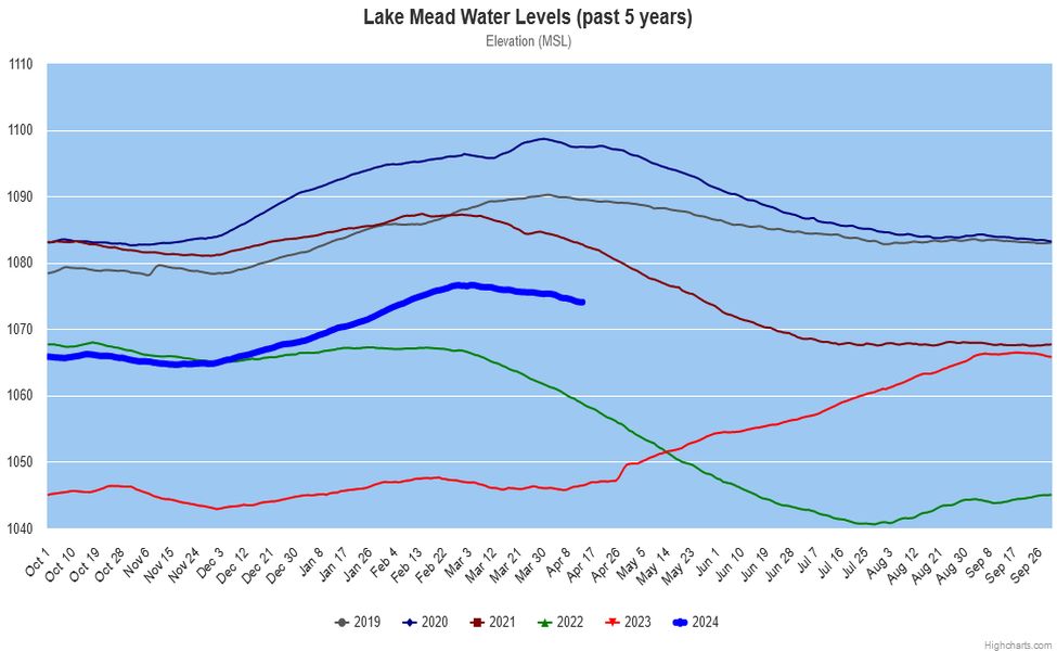
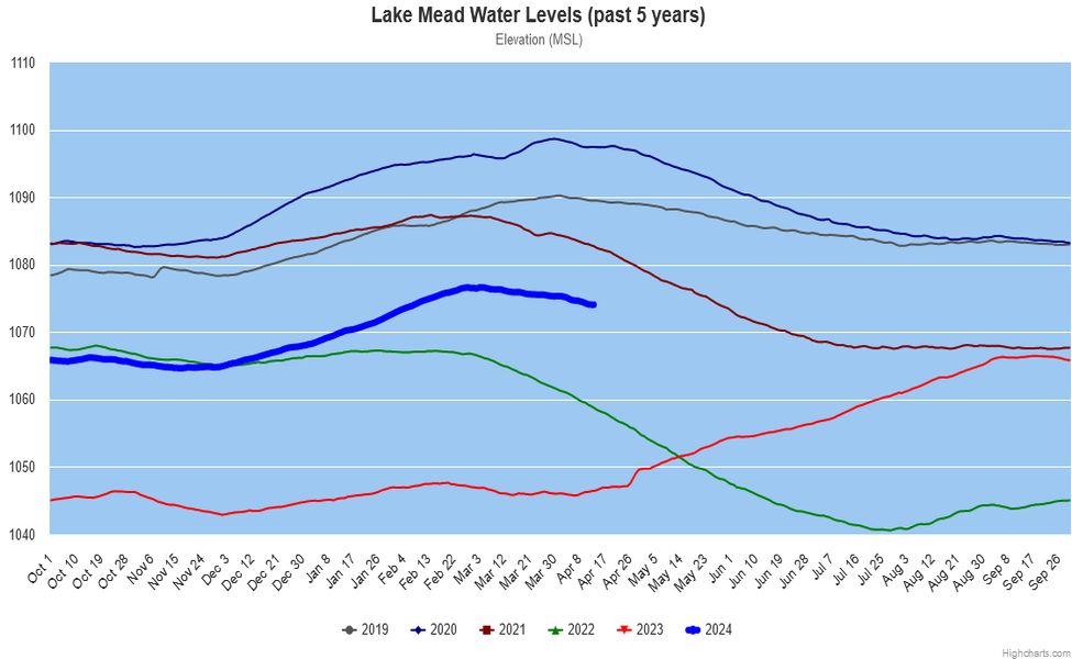
Lake Mead was at a 7-year high elevation all of 2020, set record lows in 2022-23. It is making a recovery from last year's snowpack and monsoon, now 145.5 feet (44.2 meters) below full pool at 35.6% of capacity, 27.6 feet (8.4 m) above last year, 51 feet (15.5 m) below drought level. NPS does not have a similar site for Lake Mead marinas; previous information says that Boulder Harbor (replacing closed Lake Mead Marina), Kingman Wash, South Cove, and Temple Bar marinas/boat launches are open. Government Wash Launch, Las Vegas Bay Marina, Pearce Ferry Launch, and Overton Beach Marina are closed. This is old info, others may now be closed.
The loss of water reserves in this 22-year drought is significant. Lake Powell is down 6.3 trillion gallons and Lake Mead is down 6.43 trillion gallons, a total loss of 12.743 trillion gallons of water in the two reservoirs.
Lake Powell collects the snowmelt of the Upper Colorado Basin with significant elevation changes to Lake Powell, allowing Lake Mead to maintain a more consistent elevation with measured releases from Lake Powell. The Lake Powell and Lake Mead graphs illustrate the lake elevations for the current water year plus the preceding 5 years. The Upper Colorado Basin snowpack graph shows the current and past 6 years with an average.
The US Bureau of Reclamation - the agency charged with managing water in the West Select a tile at the top of the page to view the graphs of the lakes from Water Data, constructed with data provided by the USBR. The Lake Powell graph has a gradation of ten feet while the Lake Mead graph has a gradation of five feet, providing exagerated level changes of Lake Mead when compared to Lake Powell in the graphs. This graph shows Lake Mead on the same scale as Lake Powell. Water Data prefers to emphasize elevation swings, while I prefer to show comparable elevation levels. Note that elevations are above sea level, not water depth.