Green River and the Canyons of Green River
From the Wind River Mountains of western Wyoming, Green River flows through spectacular canyons in Wyoming and Utah, with 40 miles inside western Colorado.
Much of Green River flows through desolate areas in remote canyons, some accessible only by boat, many are not identified on maps. Some canyons are lost, buried under water by the Flaming Gorge Dam.
Surviving canyons we have been able to identify include Hideout Canyon, Red Canyon, Canyon of Lodore, Whirlpool Canyon, Split Mountain Canyon, Desolation Canyon, Gray Canyon, Labrynth Canyon, and Stillwater Canyon; we probably missed some along the way; the map simply identifies Majestic Canyons
, Gates of Ladore, and Labrynth Canyon.
The combined length of Gray and Desolation Canyons, north of the city of Green River, Utah, is 120 miles with no road access other than at the south end of Gray Canyon near the city of Green River. Desolation Canyon splits the Tavaputs Plateau in two parts - East Tavaputs Plateau and West Tavaputs Plateau. At one point the rim of the Tavaputs Plateau is 5,000 feet above the river - the rim is not visible from the river. The Tavaputs Plateau was uplifted 4,000-6,000 feet (1,220-1,830 m) as part of the Colorado Plateau epeirogenic uplift (Foos, GEOLOGY OF THE COLORADO PLATEAU, page 6) with Green River deeply incising the uplifted crust, dividing the plateau, and creating these magnificent canyons.
There is a lot of confusion about the name of this road, listed on various maps and web sites as Mineral Bottom Road, White Rim Trail, BLM 129, Horsethief Trail, and Shafer Trail. And it is not the only way in or out - a 2-day trip on other trails/roads. more info and photos are in the White Rim Trail menu selection. The only direct access to the river at Mineral Bottom between Labrynth and Stillwater Canyons (the last boat/raft takeout point before the confluence with the Colorado with no takeout before the Cataract Canyon rapids) is the Mineral Bottom Road, listed by dangerousroads.org as one of the most dangerous roads in the US (often incorrectly called the White Rim Trail - more info is available from its menu option). South of Mineral Bottom, Green River enters Stillwater Canyon and Canyonlands National Park and flows through the park to its confluence with the Colorado.
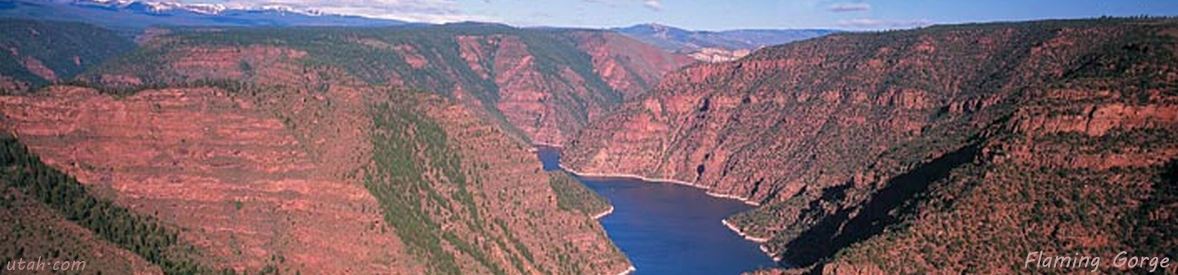
Parks and recreation areas along Green River include Fontenelle Reservoir, then end-to-end Flaming Gorge National Recreation Area, Browns Park National Wildlife Refuge, the Gates of Lodore, Dinosaur National Monument, and Green River State Park. Flaming Gorge (illustrated in the banner photo) was named by Wesley Powell after seeing the sun reflecting off the brilliant red canyon walls.
The United States Geological Survey In early river history, Green River emptied into Grand River, which, at its confluence with Little Colorado River at the eastern end of the Grand Canyon, became Colordao River for the rest of its journey to the Gulf of California. At 730 miles (1,175 km) in length, Green River is significantly longer than the Grand, and its drainage area is 70% greater than the Grand. Grand River was renamed Colorado River in 1921, ignoring the protests of the states of Wyoming, Utah, and Arizona, and the USGS, who names rivers by the longest tributary.
Island in the Sky is one of four districts in Canyonlands National Park, in the triangle created by the canyons of Green and Colorado Rivers. It has three geologic levels - Island in the Sky, which is surrounded by the White Rim (hence the White Rim Trail around it), which is bounded by Stillwater Canyon (Green River) and Meander Canyon (Colorado River). The Photo Gallery contains the photos of Green River Canyons with an auto-show of the photos.
The White Rim Trail explores trails and roads around Island in the Sky and the White Rim of Canyonlands.